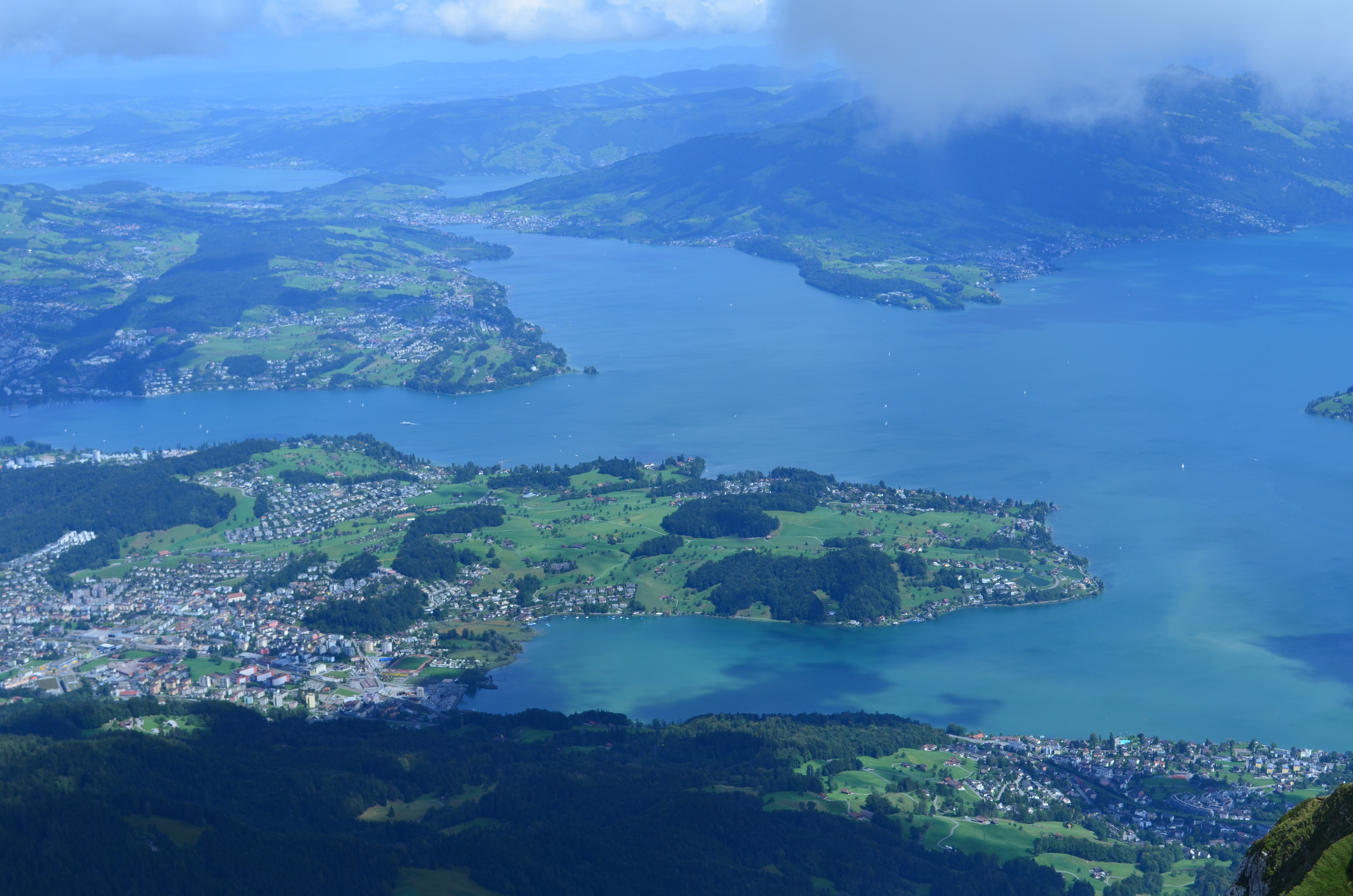
Lucerne, nestled in the heart of Switzerland, is a haven for hiking enthusiasts and in my opinion the most beautiful part of Switzerland. Surrounded by majestic mountains and blue lakes, the region offers a wide range of trails catering to various skill levels. One of the most renowned hikes in this area is the Four Lakes Hike, but there are several other trails that promise equally breathtaking experiences. In this post I will write more about my favorite hikes in the region. If you live close by, you cannot miss them. If you are here just for a weekend escape, choose one and enjoy the most stunning views!
Four Lakes Hike (Vier-Seen-Wanderung)
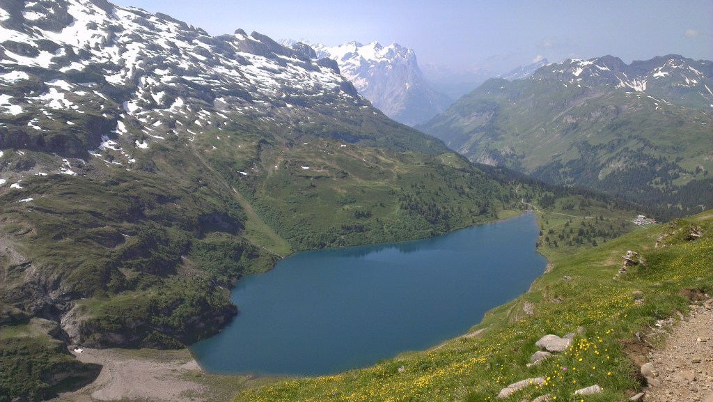
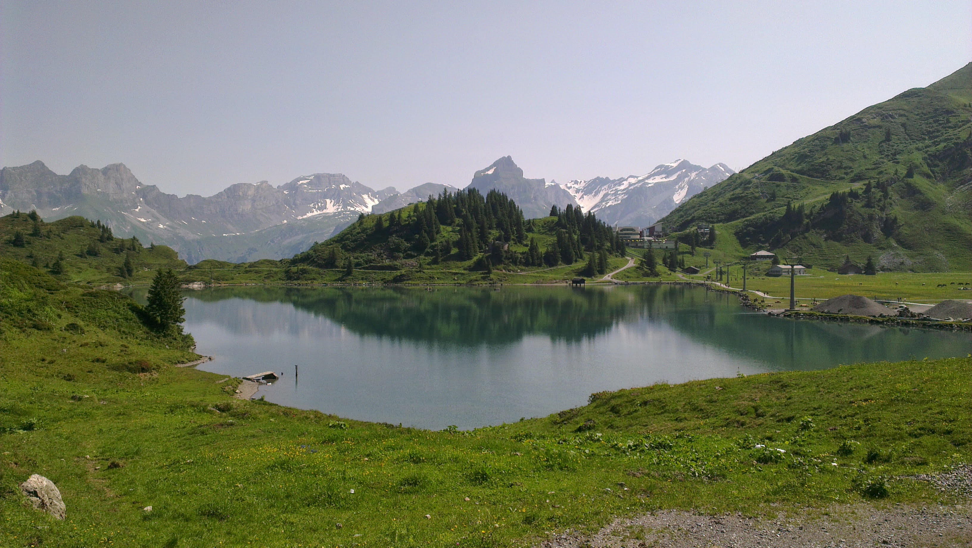
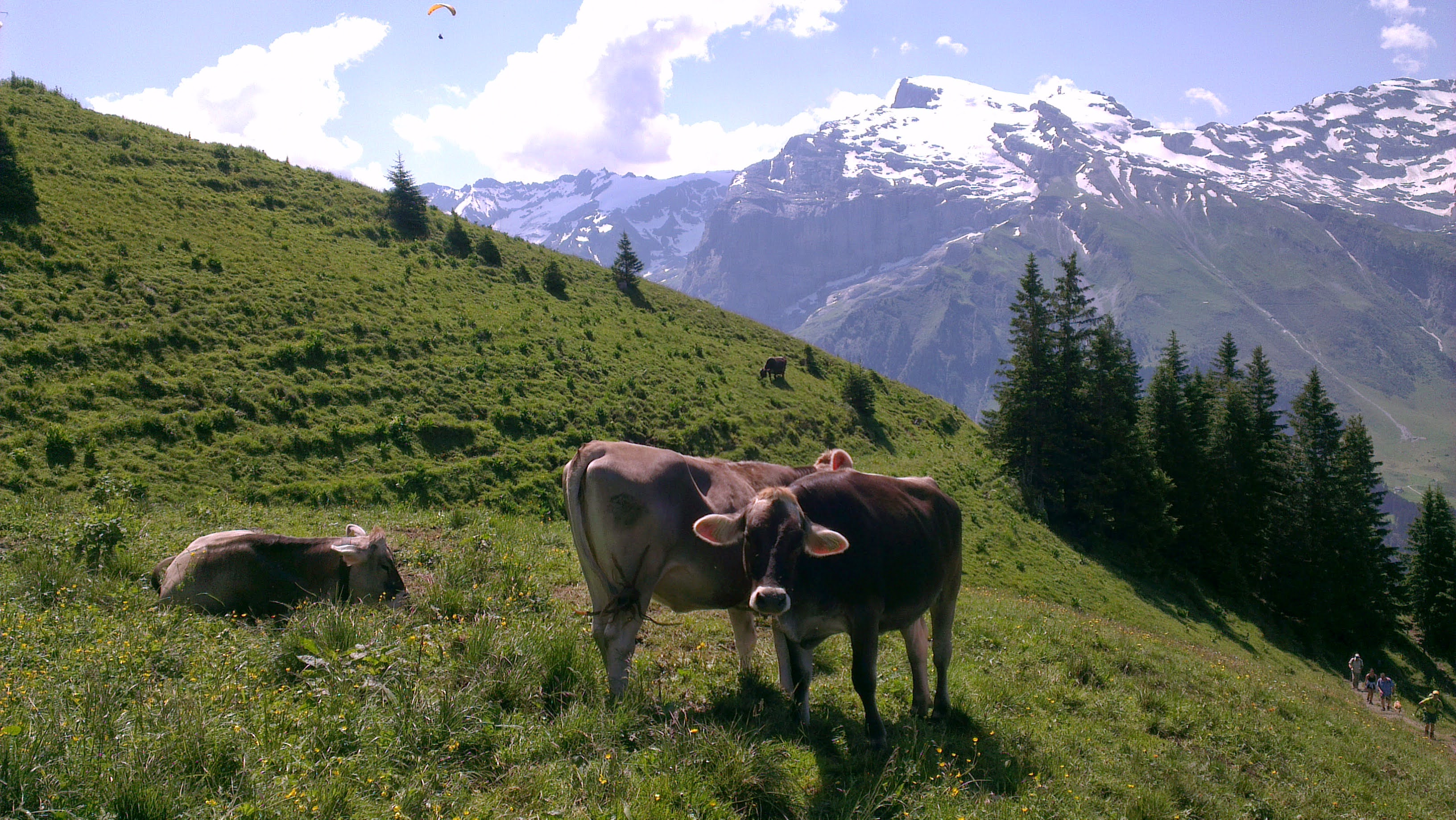
The Four Lakes Hike (Vier-Seen-Wanderung) is a picturesque alpine trail that guides you past four stunning lakes: Trübsee, Engstlensee, Tannensee, and Melchsee. Spanning approximately 15 kilometers, this moderately challenging hike offers panoramic views of the surrounding mountains and pure lake waters, making it a favorite among all sorts of hikers and families.
The trail is well-marked and offers various amenities, including picnic spots and rest areas, making it suitable for families. However, due to the trail’s length and moderate difficulty, it’s advisable to assess the readiness of younger children before embarking. Are you traveling with kids and would like to find out more about this and other kids friendly hikes in the region? Check this amazing travel blog of a family based in Zurich!
While the Four Lakes Hike is accessible during spring, summer, and autumn, it’s essential to note that conditions can vary. In winter the trail is typically covered in snow, making it suitable only for well-equipped hikers experienced in winter conditions. Snow may still be present on higher elevations during spring so remember to check the weather and bring appropriate gear. I advise you to hike this trail at least once between October and November because the foliage is truly incredible.
The hike begins at Trübsee, accessible via the Titlis Xpress gondola from Engelberg. From Trübsee, take a chairlift to Jochpass, where the trail commences. Descend towards Engstlensee, a serene lake ideal for picnics and relaxation. Continue to Tannensee, known for its turquoise waters and tranquil ambiance. The trail concludes at Melchsee, a picturesque lake surrounded by alpine meadows. The hike concludes at Melchsee-Frutt, a mountain resort area.
How to arrive there from Lucerne?
By Public Transport:
- Engelberg is well-connected with hourly direct trains from Lucerne. You can by the tickets directly online on the website of Swiss Railway Service. Upon arrival, a free local bus service links the train station to the Titlis valley station, the starting point for the Titlis Xpress gondola to Trübsee.
- By Car:
- Parking: Drive to Engelberg and park at the large parking area adjacent to the Titlis valley station. From the parking area, walk via the Titlis Xpress gondola to Trübsee, followed by the chairlift to Jochpass.
How to get back to Lucerne?
By Public Transport:
Descend via the Melchsee-Frutt gondola to Stöckalp. From here, take a PostBus to Sarnen and finally board the train back to Lucerne. It will take you approximately one hour and you can buy all necessary tickets directly on the Swiss Railway Service website.
If you arrived by car to Engelberg. Then you will need to descend to Stockalp by gondola and from there catch a bus to Kries. Then you will embark on a train to Stans and from there on a train to Engelber. It will take you around 2 hours to get back to Engelberg. At this point it is obvious that it’s much easier and quicker to rely on the impeccable public transport. Unless you don’t want to spend a night in the mountain huts along the trail and then walk back from Melchsee-Frutt to Trübsee descending to Engelberg.
Mount Rigi Panorama Trail
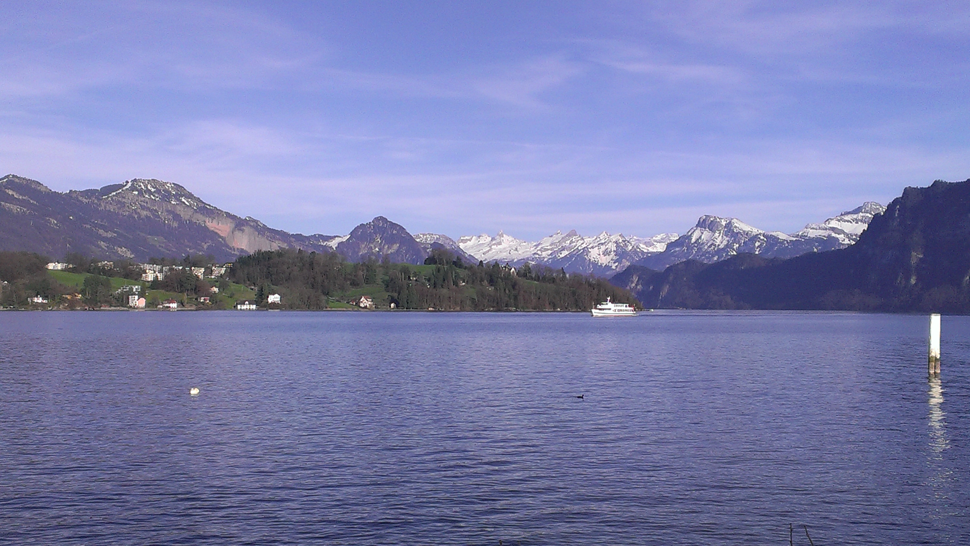
Mount Rigi, often referred to as the “Queen of the Mountains,” boasts an extensive network of trails totaling 120 kilometers. One of the most popular routes is the Rigi Panorama Trail, which offers hikers breathtaking views of Lake Lucerne and the Swiss Alps.

The Rigi Panorama Trail is a scenic hike that starts at Rigi Kulm, the highest point on Mount Rigi at 1,797 meters above sea level, and ends at Rigi Scheidegg. The trail spans approximately 7 kilometers and is suitable for hikers of various skill levels. Along the way, you’ll encounter panoramic vistas, lush meadows, and perfectly maintained paths. The route also features several picnic areas, benches, restaurants, and restrooms, ensuring a comfortable experience for all visitors. The path is well-maintained and suitable for families. In winter, certain sections are groomed for snowshoeing and winter hiking, making it a year-round destination. However, I suggest to enjoy it from March to November. Absolutely amazing colors during the autumn months.
How to arrive there from Lucerne?
By Public Transportation:
- Boat and Cogwheel Train
Begin with a picturesque boat ride from Lucerne to Vitznau, which takes about 60 minutes. The tickets can be booked directly online. Upon arrival in Vitznau, the Mount Rigi Railway station is a mere 50 meters from the dock. Board the cogwheel train to Rigi Kulm, a journey that offers stunning views and lasts approximately 41 minutes. - Train and Cogwheel Train
Alternatively, take a train from Lucerne to Arth-Goldau. From there, transfer to the cogwheel train that ascends to Rigi Kulm. This route provides a different perspective of the mountain and its surroundings.
By Car:
- Driving to Arth-Goldau
Set your GPS to Chräbelstrasse 12, 6410 Arth. A large metered parking lot is available adjacent to the Rigi mountain train station. After parking, board the cogwheel train directly to Rigi Kulm. - Driving to Vitznau: Drive to Vitznau, where parking facilities are available near the cogwheel train station. From there, take the train up to Rigi Kulm.
Stoos Ridge Hike (Klingenstock to Fronalpstock)
The Stoos Ridge Hike is one of the most breathtaking and rewarding hikes in the Swiss Alps, connecting the peaks of Klingenstock and Fronalpstock. This exhilarating 4.4-kilometer loop trail offers hikers an unforgettable experience with sweeping 360-degree panoramic views of Lake Lucerne, the rolling green valleys, and the dramatic alpine landscape. As you traverse the ridge, you’ll be treated to stunning views of snow-capped peaks, crystal-clear lakes, and charming mountain villages below.

The trail features a well-marked path, but parts of it can be steep and narrow with some moderately exposed sections. These areas are equipped with sturdy safety chains to assist hikers, making the hike suitable for those with a reasonable fitness level and some hiking experience. It is not great for families with young children. Sturdy footwear is essential, and you should be prepared for variable mountain weather conditions. The best time to hike this trail is from late spring through mid-autumn, when the trail is free of snow and the views are at their most spectacular.
How to get there from Lucerne:
By Public Transportation:
Take a train from Lucerne to Schwyz, which takes approximately 50 minutes. From Schwyz, catch a bus to the Stoosbahn funicular station. The Stoosbahn is the steepest funicular railway in the world and offers a thrilling 5-minute ride up to the car-free village of Stoos, where your hiking adventure begins. Once in Stoos, follow signs to the Klingenstock chairlift, which takes you up to the start of the ridge trail. It’s a loop trail so you go back to Lucerne the same way.
Mount Pilatus Trails
Towering over Lucerne at 2,128 meters, Mount Pilatus is a local favorite. When I was living in Lucerne and complaining about cloudy weather in winter, the locals would tell to simply go up to the Pilatus summit, above the clouds. It’s true, the summit is often sunny even in winter and it’s always a magical experience to go up to the top of this mountain – especially hiking up is truly incredible. There are several routes to the summit, ranging from challenging hikes to more leisurely paths that can be combined with cable car or cogwheel train rides. The effort is rewarded with unparalleled views of Lucerne, its lake, and the distant Alps. There are plenty of trails in the Pilatus area and you can have a look on all trails to find the one that suites you best. Here below I will write some more about the trail that runs from Kriens (a little town close to Lucerne) to the very top of the mountain.
The hike from Kriens to the Pilatus summit is one of the most iconic and rewarding trails near Lucerne, offering a perfect combination of natural beauty, challenging terrain, and breathtaking views. This 11.9-kilometer point-to-point trail begins in the charming town of Kriens and ascends to the Pilatus Kulm, which stands at an impressive 2,106 meters above sea level. Generally considered a challenging route, it takes an average of 5-6 hours to complete, though this can vary depending on pace and weather conditions.
The trail will lead you through a diverse and picturesque landscape, including green pastures, dense forests, and rocky alpine paths. As you climb up, you’ll be rewarded with increasingly spectacular views of Lake Lucerne and the surrounding Alps. The trail is well-marked, but it’s important to wear sturdy hiking shoes and bring plenty of water, especially in the warmer summer months when the ascent can be quite demanding.

How to get there from Lucerne?
The starting point of the hike is easily accessible from Lucerne. Take a short 10-minute bus ride (bus line 1) from Lucerne’s main train station to the Kriens Zentrum Pilatus bus stop. From there, follow the signs toward the Pilatus cable car station, which also marks the starting point of the trail. As said before the trail is well signed so you will have no trouble to find it and following it. Once you reach the Pilatus Kulm summit, you’ll find several amenities, including restaurants, a viewing platform, and even the historic Pilatus Kulm Hotel. After soaking in the breathtaking panoramic views, you have several options for returning to Lucerne. You can take the scenic Pilatusbahn, the world’s steepest cogwheel railway, down to Alpnachstad, where you can catch a direct train back to Lucerne. You can buy the train tickets directly on the railway website. Alternatively, you can descend via the cable car back to Kriens and take the bus from Kriens Zentrum Pilatus to Lucerne. Or you can walk back the same trail to Kriens.
The best time to embark on this hike is from May through October when the trail is clear of snow and the conditions are most favorable. Remember that this is a demanding trail so hike it only if you are in a really excellent physical condition.
Niederbauen Kulm
Often considered a hidden place, the hike to Niederbauen Kulm stands at an elevation of 1,923 meters and offers some of the most spectacular and rewarding views of Lake Lucerne and the surrounding mountain ranges. The trail is less popular among tourists, making it an ideal destination for those of you who are seeking a serene and peaceful hiking experience. The ascent is challenging, but the panoramic views from the summit — featuring crystal-clear lakes, lush green mountains, and distant snow-capped peaks — make the effort well worth it. It’s not suitable for families with young kids and a certain level of physical condition is required to complete this hike.
The hike itself follows well-marked trails, but the terrain can be steep and demanding at times, requiring a good level of fitness and proper hiking shoes. Along the way, you will pass through picturesque alpine landscapes, dense forests, and open ridges, offering plenty of opportunities to stop and take in the stunning scenery. The best time to undertake this hike is from late spring to early autumn when the path is clear of snow and the visibility is at its best without clouds or fog.
How to get there from Lucerne?
To reach the starting point of the hike, take a train from Lucerne to Stans, a journey of approximately 20 minutes. From Stans, take a short bus ride to Emmetten. Once in Emmetten, you have the option to take the Niederbauen cable car up to the Niederbauen station, which serves as the trailhead for the hike. Alternatively, you can hike from Emmetten itself, adding a few extra kilometers and elevation gain to the adventure.

As you can see, Lucerne and surroundings offer plenty of options for nature lovers. Before setting out, remember to check local conditions. Always ensure you’re equipped with appropriate gear, inform someone about your hiking plans. Lace up your shoes and hike safely!

Leave a comment