I promised a dedicated post about hiking on the island of Terceira (Azores) and here it comes. Terceira in fact offers a diverse range of hiking trails that showcase its unique volcanic landscapes, lush forests, and rich biodiversity. In this post I will write about 4 trails that I walked last year. Each of these routes provides a distinct and unique experience. If you want to have the complete overview of the trails on the island check Visit Azores website.
1. Algar do Carvão – Furnas do Enxofre (PRC10 TER)
- Length: 6.2 km
- Duration: Approximately 2 hours and 30 minutes
- Difficulty: Medium
- Type: Circular
- Altitude Range: 522 m to 629 m
- Starting Point Coordinates: 38.72811, -27.21655
This trail offers an incredible journey through the central plateau of Terceira, connecting two significant natural monuments: Algar do Carvão volcanic cavity and the Furnas do Enxofre fumarolic field. As you begin the hike, you’re immediately immersed in the heart of Terceira’s volcanic interior, where the landscape reflects both the island’s tumultuous geological past and its lush present.
The path meanders through ancient native forests dominated by species such as Laurus azorica (Azorean laurel), Juniperus brevifolia (Azorean juniper), and Erica azorica (Azorean heather). These endemic plants form dense, green tunnels that embrace hikers in a cool, misty ambiance, especially in the early morning or late afternoon. This Laurissilva forest, a relic from the Tertiary period, is not only visually stunning but also ecologically vital, providing habitat for many of the island’s native birds and insects.
As the trail ascends and descends across gentle slopes, you will encounter geothermal phenomena such as steaming vents and sulfur-rich mud pools. These are particularly prominent as you near Furnas do Enxofre, where the landscape suddenly transforms into a surreal, otherworldly scene. The ground is hot to the touch in places, and the air carries the distinctive scent of sulfur. Plumes of steam rise from the earth, and mineral deposits paint the soil in shades of yellow, orange, and white. It’s a powerful reminder that Terceira remains geologically active.
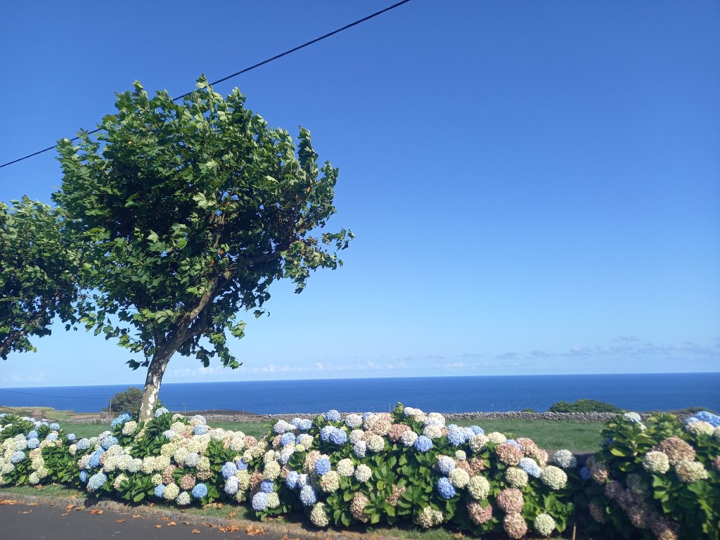
This route also provides several vantage points where hikers can pause and take in sweeping views of the island’s lush interior. On clear days, you may catch sight of the patchwork of volcanic cones that characterize Terceira’s landscape, with rolling green pastures separated by dark volcanic stone walls. In the distance, the blue Atlantic glimmers on the horizon, and you might even glimpse other islands in the central group of the Azores.
This route is more than a simple nature walk — it’s a living museum of volcanic history. Along the way, interpretive signs will help you to understand the significance of the various features, from the formation of the lava caves to the unique flora sustained by the island’s microclimates.

Highlights:
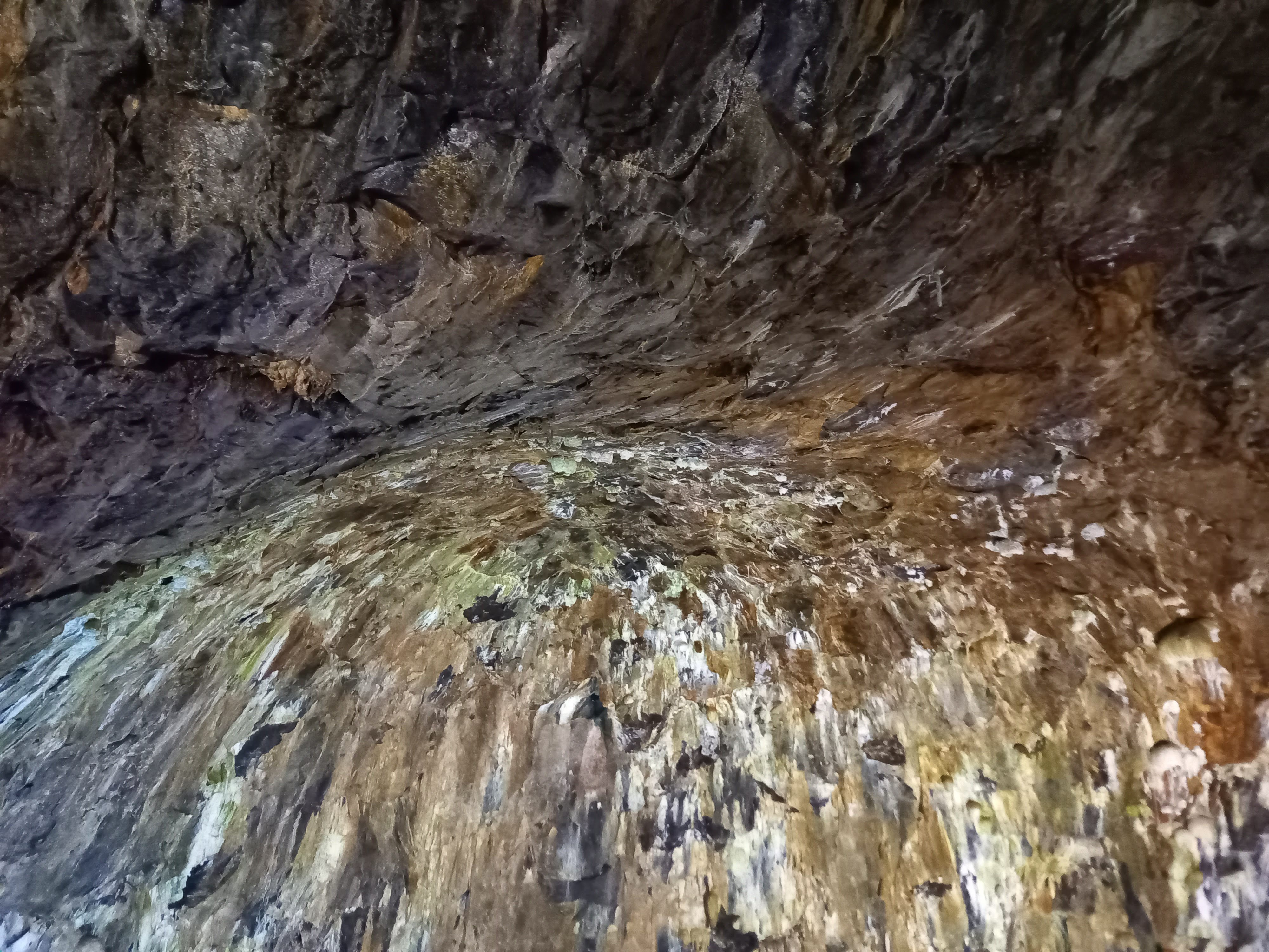
- Algar do Carvão: A remarkable volcanic vent featuring unique silicate stalactites and a subterranean lake. The cave reaches a depth of approximately 90 meters and is accessible to visitors during specific months.
- Furnas do Enxofre: An area characterized by active fumaroles emitting steam and sulfurous gases, indicative of the island’s volcanic activity.
- Laurissilva Forest: A type of subtropical rainforest, rich in endemic plant species, providing a lush backdrop to the trail.
- Panoramic Vistas: On clear mornings you will be able to see Pico do Alpanaque, Caldeira do Guilherme Moniz, and even the distant islands of São Jorge and Pico.
Recommendations:
- Footwear: Sturdy hiking boots are advised due to uneven terrain.
- Weather: Check local conditions before starting, as weather can change rapidly. I advise to hike this trail in the morning to have more probability of a clear sky.
- Navigation: the trail is super well marked but carrying a GPS device or and off line map is always a good idea..
2. Mistérios Negros (PRC01 TER)
- Length: 4.9 km
- Duration: Approximately 2 hours and 30 minutes
- Difficulty: Difficult
- Type: Circular
- Altitude Range: 548 m to 641 m
- Starting Point Coordinates: 38.73791, -27.26802
This circular trail is one of the most iconic and immersive hikes on Terceira Island. It will bring you into the heart of the island’s untamed wilderness. Named after the dark volcanic domes formed during eruptions in the 18th century — the so-called “black mysteries” — the Mistérios Negros trail takes you deep into a pristine and rugged landscape shaped by fire, cloaked in green, and teeming with life.
The trail begins near the Gruta do Natal, at the base of the Serra de Santa Bárbara massif, and immediately leads you into dense forest. Here, you will find yourself surrounded by the Azorean Laurissilva — a thick, prehistoric forest made up of endemic tree species that have survived since the last ice age. The path narrows as it weaves through tunnels of green, creating a quiet, intimate hiking experience. Juts imagine the moss carpet on the ground and on the trees, the mist in the air and some bird singing. The scenery is truly fantastic.
As the trail gains elevation, you will reach the volcanic domes — stark, jet-black formations of solidified trachyte lava that loom mysteriously among the greenery. These are the namesake “mysteries,” remnants of eruptions from 1761, when the earth split and spewed new terrain across the landscape. The contrast between these raw, dark rocks and the surrounding lush vegetation is striking. It gives you an idea how the destroyed nature can reborn.
Partway through the trail, you’ll arrive at the Lagoinhas do Vale Fundo, a trio of small volcanic-origin ponds nestled in a secluded valley. One of these lagoons retains water year-round and serves as a stopover point for migratory birds. It’s a peaceful, secluded spot — perfect for a break.
The trail then continue near the base of Pico Gaspar, a perfect conical volcano that rises above the forest canopy. If you feel adventurous, you can climb to the crater’s rim for breathtaking views across the western half of the island, including the Serra de Santa Bárbara and the island’s patchwork fields.
Throughout the hike, the trail is rich in biodiversity, with endemic ferns, mosses, and wildflowers lining the way. It’s not uncommon to spot rare species like the Azorean wood pigeon or the tiny goldcrest flitting between branches.
Due to its dense undergrowth, slippery paths, and frequent mud, Mistérios Negros is rated as difficult and should only be undertaken by well-prepared hikers with good boots and weatherproof clothing. However, for those who are up for the challenge, this trail rewards with some of the most magical and untouched scenery in the Azores — a living snapshot of the island’s wild heart.

Highlights:
- Endemic Flora: The trail is rich in native plant species, including Azorean Heather, Juniper, and Blueberry.
- Lagoinhas do Vale Fundo: Three small lagoons, one of which retains water year-round, serving as habitats for migratory birds.
- Volcanic Domes: The “black mysteries” refer to the dark trachytic domes formed during past volcanic activity.
- Pico Gaspar: An optional detour leads to this peak, offering expansive views of the island’s central massif
Recommendations:
- Preparation: It’s rated as difficult mainly because of the mud, however don’t get discouraged. It’s not a long trail and the elevation gain is ok, so just make sure the have the right equipment and if you are used to mountain walks, you will be fine hiking this trail.
- Equipment: Waterproof gear is advisable, as the area can be damp and muddy.
- Navigation: A GPS device is recommended to stay on track but as all the other Azorean trails you will find the signs everywhere.
3. Masha Grande – Biscoitos
- Length: Approximately 10 km
- Duration: Approximately 3 hours
- Difficulty: Moderate
- Type: Linear
- Starting Point: Masha Grande
- Ending Point: Biscoitos
Stretching from the elevated forested area of Masha Grande to the coastal lava fields of Biscoitos, this trail is a beautifully varied linear route that showcases the dramatic shifts in Terceira’s landscape — from quiet, green interior to rugged volcanic coast.
The trail begins in the misty woods of Masha Grande, a serene highland zone carpeted in endemic vegetation and ferns. Early sections of the path wind gently through pine forests and past eucalyptus groves, accompanied by the tranquil sounds of birdsong and the occasional bubbling of distant springs. The air is crisp and cool in the higher elevations, and morning fog often drapes the landscape in a dreamlike quality.
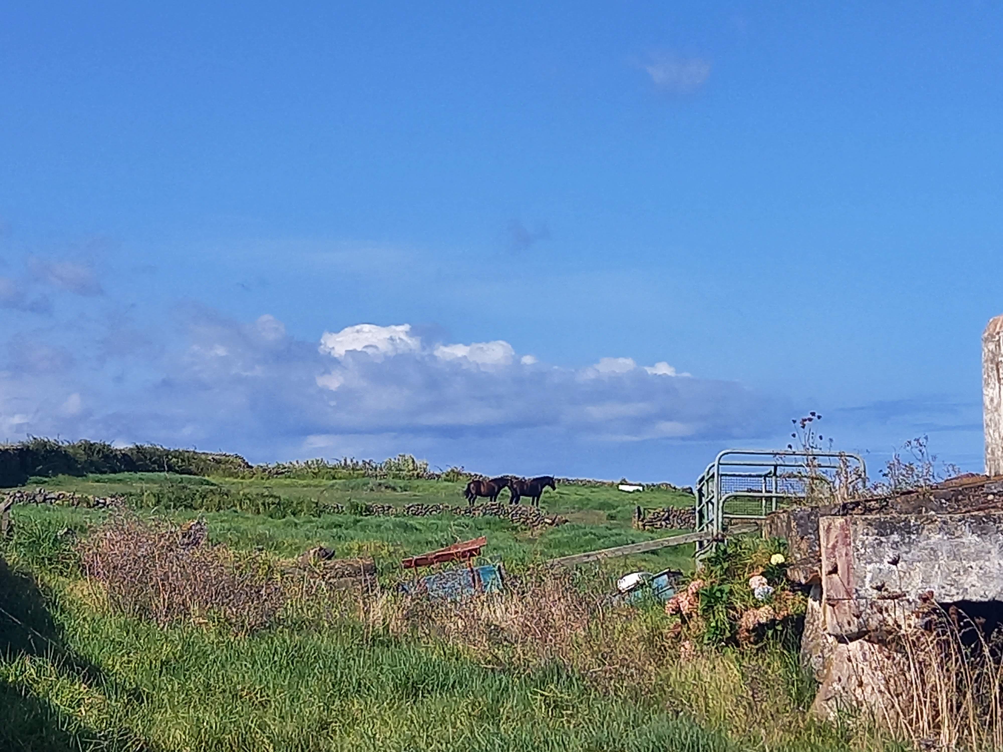
As you keep on walking, the scenery gradually opens up to wide meadows and agricultural lands. These middle sections offer insight into Terceira’s rural life, where cows graze on volcanic pastures bounded by traditional dry-stone walls. You may pass small farmhouses, old stone huts (known locally as palheiros), and ancient trails once used by farmers and herders navigating between the coast and the interior.
Continuing toward the coast, the trail begins a gentle descent. In the distance, the shimmering Atlantic Ocean begins to dominate the view. You’ll pass through stretches of wild scrub and low coastal vegetation before finally arriving in Biscoitos, a charming village famous for its wine and natural swimming pools carved out of black basalt.
The end of the trail is a destination in itself. Biscoitos’ volcanic coastline is among the most visually striking on the island. Here, lava flows have formed natural inlets and tidal pools, now used as public bathing areas. The water is crystal clear, and the contrast between the azure sea and the jagged black rocks is unforgettable. It’s a perfect reward after a long hike — bring a swimsuit!

Nearby, the Museu do Vinho dos Biscoitos (Wine Museum) offers an opportunity to learn about the region’s unique viticulture. The area is known for its Verdelho wine, produced in vineyards that grow on volcanic soil, protected by stone walls from the salty Atlantic winds.
This trail is moderately difficult mainly due to its length (about 10 km) and its linear nature — you’ll need to arrange transport back to the starting point if you’re not planning to walk the route in reverse. I advice you to go back by a taxi or stay for the night in Biscoitos and walk back the day after. It’s long but it’s worth taking it slowly.
Highlights:
- Diverse Landscapes: The path transitions from forested areas to open fields and finally to the rugged coastline.
- Cultural Sites: Along the way, hikers may encounter traditional Azorean architecture and agricultural practices.
- Biscoitos Natural Pools: A perfect spot to relax and swim after the hike, these pools are a testament to the island’s volcanic origins.
Recommendations:
- Transportation: As this is a linear trail, arranging transportation back from Biscoitos is necessary if you don’t plan to walk back.
- Timing: Starting early allows ample time to enjoy the natural pools at the end.
4. Passagem das Bestas (PRC08 TER)
- Length: 4.7 km
- Duration: About 2 hours
- Difficulty: Easy to Moderate
- Type: Circular
- Starting Point: Near the picnic area of Mata da Serreta (GPS: 38.7329, -27.3664)
Tucked away in the heart of Terceira’s lush landscape, the Passagem das Bestas trail is a circular hike that combines natural beauty, deep forest immersion, and a fascinating cultural past. The name “Passagem das Bestas” translates to “Passage of the Beasts,” a reference to the trail’s historical use by herders who drove cattle and pack animals through the woods along this ancient path. Today, it offers a serene journey through one of the island’s most enchanting forested areas.
From the very first steps, the trail leads you into a peaceful, dense forest located in the Mata da Serreta — a reforested area in the western part of the island. This region is one of Terceira’s best-kept secrets, rarely crowded and offering a chance for true solitude. Tall cryptomeria (Japanese cedar), eucalyptus, and acacia trees form towering walls of green that line the path, their canopy filtering sunlight into shifting patterns on the forest floor.
Beneath your feet, the trail is often soft with pine needles and moss, and it winds through small hills and gentle depressions created by the island’s volcanic past. You might hear little more than the chirp of Azorean chaffinches or the breeze rustling the leaves above. In wetter months, the trail becomes misty and humid, cloaking the forest in a quiet, magical veil that evokes the feeling of walking through a fantasy novel.
As the name suggests, this route wasn’t designed for tourists — it’s a centuries-old passage once used to move livestock and goods between inland pastures and the coast. Along the way, you’ll spot remnants of this past: stone paths worn smooth by hooves, moss-covered walls that once corralled animals, and shallow troughs dug by the weight of generations of oxen and cattle.
Walking here offers more than just natural beauty — it’s a tangible connection to the lives of Terceira’s early settlers, who had to carve out routes through volcanic forest to sustain their way of life. The trail gently honors this heritage, preserving the textures of the past without modern disruption.
Though most of the hike is within the embrace of the forest, certain stretches open up to clearings and scenic lookouts, where you can catch glimpses of the island’s undulating green hills and pastures stretching out to the horizon. On especially clear days, you might even see the coastline and the blue shimmer of the Atlantic far in the distance.
Highlights
- Native and endemic plants: especially along the more humid and shaded segments. Ferns, mosses, and flowering shrubs add bursts of color and texture to the path, particularly in spring and early summer.
- The air is perfumed with earthy scents — wood, sap, wet leaves — and the quiet is often punctuated by birdsong and the distant sound of trickling water.
- There’s a well-maintained picnic area at Mata da Serreta, which makes for a pleasant pre- or post-hike rest stop. Bring a picnic or snacks, and enjoy the quiet serenity of the woods — a welcome escape from the pace of modern life.
Passagem das Bestas is ideal for those looking for a shorter, more relaxed hike that doesn’t sacrifice beauty or interest. It’s well-marked and easy to follow, making it a good option for families or anyone wanting to connect with nature without tackling major elevation changes.
Remember to check the Visit Azores website here if you want to find the complete list of hiking trails in Terceira. Choose your path and book your flight. Asking yourself how to get to Azores and what else can you do on Terceira Island? Check my dedicated post here.

Leave a comment